Mountains, hills, plains: Piedmont is truly a varied land. Only the sea is missing. We are sure? Because if you think about it in Piedmont there is also that. Just go to a peak of the Apennines, above Ovada, and you can see the sea just below. A horizon of light that dissolves into infinity.
Then it is the sea that plays a decisive role in the rich nature (biodiversity) of the region. In the sense that it affects the climate and it is precisely the sea, the Ligurian Sea, which together with the oceanic companions decided that today, Sunday 11 October, year 2020 of the era called "Anthropocene", that history will deliver to posterity as the year of the covid ... there is a vague sun that is shy peeking through the clouds. And so you go pedaling. In the hills, that the autumn hills are really beautiful (but in spring it is the same). Astigiano, Monferrato and Alta Langa are known to me, from the "pedaling" point of view I miss the Roero.
“The Rocche del Roero, characteristic of the homonymous area called Roero (Piedmont), are the result of a geological phenomenon of erosion characterized by deep ravines and picturesque gullies generated following the so-called“ Capture of the Tanaro ”. This from Italian Wikipedia.
Capture of the Tanaro? Given the recent disasters combined by this river (the longest entirely Piedmontese) it sounds strange. In reality the Tanaro and other rivers and streams should be left free to wander rather than capture them, for their and our good. Having said that, the geological phenomenon called "Capture of the Tanaro" occurred about 250,000 years ago, a distant era in which rivers and streams wandered without causing damage to anthropogenic communities.
The area called "Roero" is located there in the middle of Piedmont, between Langhe and Asti.
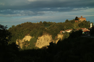
The Rocche characterize the landscape, they are the geological emblem (extraordinary are those of Pocapaglia). A long ridge of chasms and sandstone walls, of wild rivers, the kingdom of the forest. And it is precisely the contrast between these wilderness environments and the reassuring outline of vineyards and hazelnut groves that makes the difference.
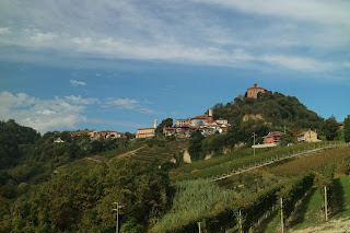
Then there are the villages with their castles, poised over the chasms, landing in the sea of vineyards.
Bold descents and ascents
The reference to the great Lucio and the "Emotions" he generated is discounted. Going up and down is typical of all hills, but in this area it becomes even more pressing.
No more chatter, we ride. Departure from Montà, home to the Rocche del Roero Ecomuseum, an info point on everything about the area. You go on a slight slope in the direction of Santo Stefano Roero, but as soon as you reach the edge of the town you will come across the first point of interest.
On the edge of the ridge on the left, hidden in the vegetation and reachable with a short detour, is the
Santuario dei Piloni, consisting of a Romanesque church and the thirteen chapels of the devotional path of the Via Crucis.
It is the smallest Piedmontese sacred mountain and, although not included in the official system of the Sacri Monti (UNESCO heritage), it is more than ever worthy of interest, also for the suggestive place where it stands, known as Valdiana (Vallis Dianae ), an area of woods and ravines already consecrated to the goddess of hunting in the pagan age.
Back on the road to Santo Stefano, continue in a southerly direction reaching in about a kilometer in the locality of Madonna delle Grazie (from the church of the same name). At this point, the recommended route leaves the provincial road and turns right into the town (no indication) to head into the quiet of a secondary road that descends into a beautiful wooded environment and joins the provincial road to Carmagnola and Ceresole d'Alba.
In a light, relaxing glide you follow the provincial road, which is moreover with little traffic. In Località San Lorenzo, a hamlet of Santo Stefano Roero, turn left to take a side road with the indication “Cappelli - San Grato”. Also this "provincial", but with practically no traffic.
Between scattered houses and hazelnut groves. With Monviso on the horizon and a truly "granda" (big) chestnut
You go up in winding hairpin bends, at first among scattered mansions, then the hazelnut monoculture takes over.
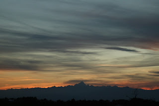
At the end of the climb you go on a panoramic ridge parallel to the mountains of Re Cozio, with the Re delle Cozie in exuberant evidence. His Majesty the Face monopolizes the eyes, an inevitable condition in favorable weather.
A stretch to sip, then also the hazelnut grove gives way to the
deciduous wood typical of the Roero. Its wilderness soul, together with the fortresses.
San Grato: don't expect a village, this whole area bears the name of the saint thaumaturge, patron saint of Aosta. And so the ride extends for a long time and pleasantly between one core of San Grato and the other, housed on a wide and rustic ridge.
And it is in a nucleus of mansions in the “San Grato” area, Villa Superiore, that the Roero exhibits itself in a “grand” wonder. An age-old chestnut, called “Castagna Granda”.
Which, like so many wonders, requires a pledge: the descent of the steep cart track that leads into the valley below ("Castagna Granda" hiking trail sign), a cart track that can be done on a bike with suitable means and various acrobatics.
And here it is, as soon as you put your foot back or rotate on the surface, the castagnone. At the center of a verdant clearing, surrounded by other chestnut trees, also centuries old, the arboreal monument amazes for its circumference: over 10 meters! Measure to believe. How? With a group hug, a system with which a dutiful homage is also paid to ours.
Once back up, a final stretch of hazelnut groves leads to the main road to Monteu, a few rides from the town.
Monteu, on the edge of the abyss ...This is how the village appears with its manor. An appropriate stop allows you to appreciate the scenic location.
And no less spectacular is the view of the circus of fortresses that can be appreciated both from the overpass and from the rest area at the entrance to the town. Once the anxiety of fortresses subsided (for now), we descend in the opposite direction, towards Canale.
But another is (for now) the goal. Santo Stefano is the destination. Santo Stefano Roero, twin village of Monteu which is in a pleasant position on the opposite edge of a wide valley.
A tight hairpin is the right spot for photographic compositions, and other points no less will follow shortly.
The geometric rows facilitate the task. But you need to keep an eye ... Just as you need to keep an eye (on the road) in the following steep descent, at the bottom of which you leave the road to Canale and turn north towards Santo Stefano.
Not before, however, should be appreciated properly, on the opposite side, the Ciabòt San Giorgio, in a unique position on the top of the homonymous cru of Roero DOCG. The Ciabòt is made with ashlars from the ancient castle of Pulciano, which stood here before the year 1000.
A remarkable whole, a starting point for another photo-graphic composition. And yet another (not least) composition will follow shortly.
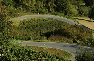
Hairpin bends, sinuous hairpin bends
A stretch for demanding and sensitive riders, with good aesthetic sense and an open mind to the harmonies of the landscape.
Pedaling is believing, but pedaling with a constant and slow pace, so that the effort of climbing does not obscure the view and prevent you from appreciating the sequence of hairpin bends with which the road cuts (and does not offend) the vineyard slope.
The slope, which in turn is constant and not excessive, facilitates the task and once at the top you can stop to admire the work, certainly not of a very human nature, but sometimes even a strip of asphalt can be art.
Am I exaggerating? Perhaps, in any case, the whole allows once again to show off their photo-graphic skills (this stretch of road is in fact a real must for cyclists and photo amateurs of the Roero). Soon, a work instead of nature, but in singular alliance with a human work, awaits the riders in Santo Stefano. Sensitive pedals, of course.
The Rocca and the Parish Church
Having gained the ridge, turn left into the town to reach the opposite edge where you can appreciate the "singular alliance", fusion and contrast at the same time, between the wild blow of the characteristic Rocca (monument of nature) and the dedicated Parish Church in Santa Maria del Podio (human work). And nearby there is still a chasm of sandstone walls (the work of the Tanaro).
It reverses direction, remaining high to head on the road to Canale. A long glide in the Valle dei Lunghi leads to this center not on the ridge but on the bottom of the valley, which can be crossed by appreciating the arcades on the side of the "main road" and the cobbled streets that one goes through to go to Montà. The next goal. And point of arrival ...
San Nicolao, the heart of the Roero wilderness
Montà next destination? Well no, the trip reserves another surprise of these hills: the naturalistic oasis of San Nicolao (named after a votive pillar). Nature protected and partly rebuilt thanks to the meritorious work of the volunteers of Canale Ecologia.
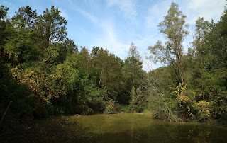
And so sensitive pedalers, just outside the Canale, at the end of the residential Via Torino, can give in to the invitation and naturalistic lure of the special signpost to head down a secluded road that leads into a welcoming valley. After half a kilometer, you leave the asphalt "of the secluded road" to head to an even more secluded area. Here begins the oasis, an area wisely off-limits to bicycles. A half-hour walk takes you to the Biotope delle Rocche, a small lake-wetland, the heart of the oasis (the footpath continues up to Montà). Honor to the volunteers of Canale Ecologia. Have ...
Back on the provincial road, a series of elongated hairpin bends raises Montà ((the climb is called Renna or Redina). Montà d’Alba, its historic center at the top, the walk alongside the castle and its park.
The Path
Download
here the GPX file









No comments:
Post a Comment